
Circle of Silver: Tenacity
Words By: Elladee Brown
Images By: Anne Keller
The night before the Silvercup Ridge attempt, our crew gathered around Brian’s massive paper topo maps spread across the dining room table at Trout Lake’s Windsor Hotel.
He walked us through the maze of trails and forest service roads that crisscross the Silvercup, each running parallel to the next at different elevations. Some of what he showed us wasn’t on the map at all, just reference points for where we might find ourselves. Even with GPS, these routes often vanish into scree fields or simply fade away. Winter rewrites access up here, and what worked last year might not be passable this year. After riding Triune Mine the day before, we reviewed the elevation profile and current trail conditions. We all agreed that the best way to tackle the entirety of the Silvercup was to split it into two days.
The Silvercup is special. It’s the longest ridge ride in the Kootenays, and probably BC…16 miles of ridge riding from start to finish. But it involves the ‘getting there’ part, the approach. Tip to tail, after two days of riding, we were anticipating about 40 miles with four to five thousand feet of climbing and descending on our eMTBs.
There are a few ‘roads’ that connect to the Silvercup Ridge from the Lardeau Valley below, where the town of Trout Lake lies.
The word ‘road’ is used lightly here…they’re mostly steep, loose doubletracks in varying conditions of disrepair. For day one, we plotted a route that would connect the northern part of the Silvercup Trail to a mid-point access called Rady Road, where we’d descend to the valley after completing the first day on the ridge.
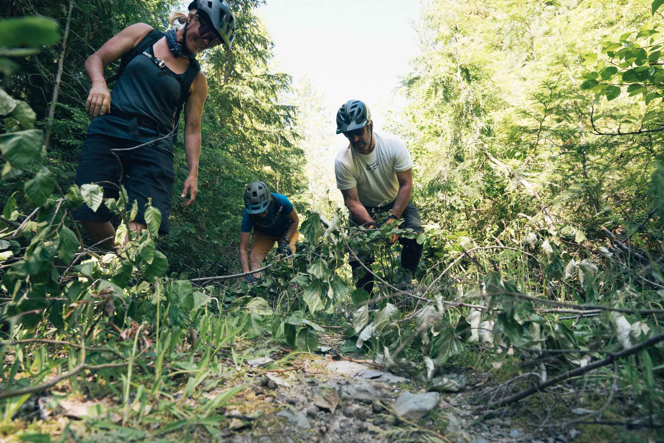
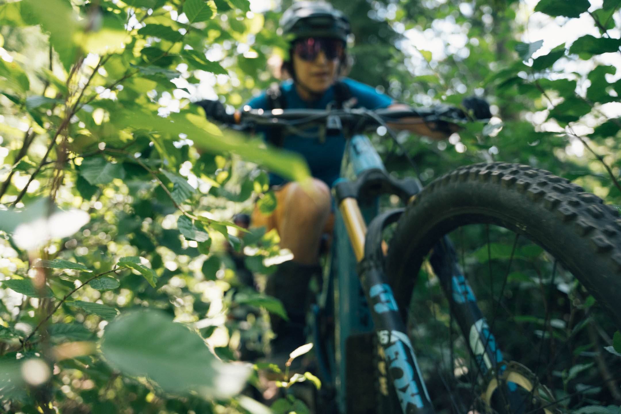
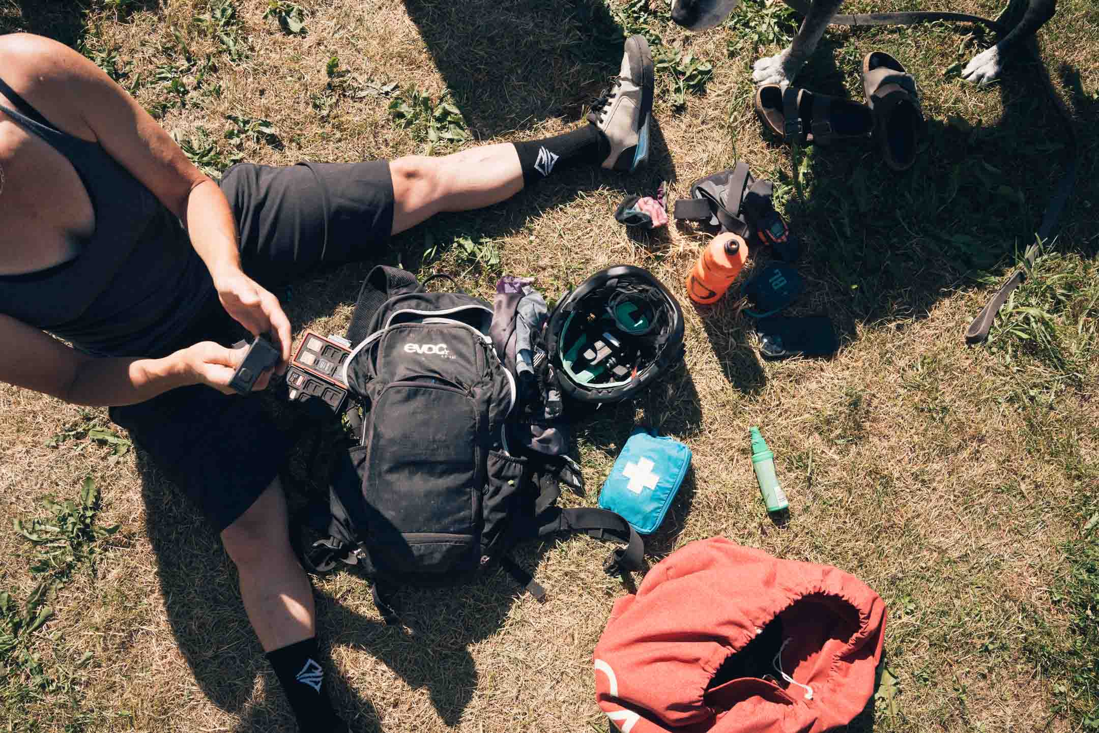
With a solid plan in place, Larry, Kim, Jen, Anne, and I were eager to set off on this adventure. After breakfast at the Windsor Hotel, Charity chauffeured the five of us up the aptly named ‘Dirt Road forest service road until it eventually dead-ended. The singletrack picked up where the road left off in an overgrown tunnel of alders. Brian had cleared this section the previous week, and at his request, we tossed the branches he’d cut to the side and then launched into a steep, technical, and overgrown climb. A climb not even remotely possible on a meat bike, but doable, albeit very technical, on an eMTB.
Amongst the forest we blasted tunes on an external speaker,
because bear poop was everywhere.
Bears appreciate a heads-up, and we were happy to accommodate, especially out here, where the corners are blind and the berries plentiful. Where there’s abundant food, there are abundant bears.
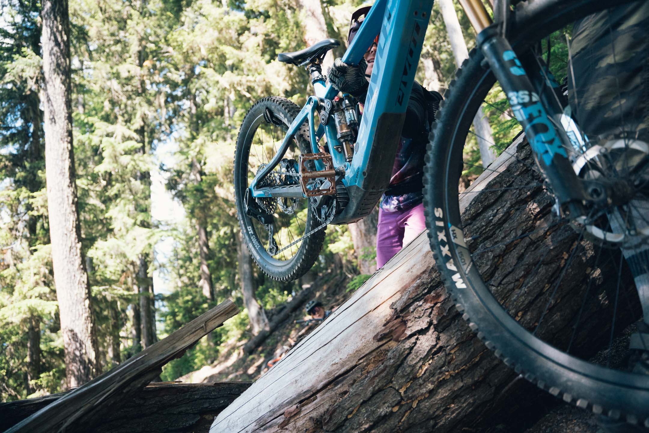
The trail, mostly bench-cut, was littered with fallen trees or ‘blowdown.’ Forced to carry our bikes over logs of every size, progress was slow and exhausting. Larry took it upon himself to manhandle and move some of the smaller logs off the trail. We appreciated it. Some gave way, some didn’t…
About a third of the way up the singletrack,
Larry grabbed a thick branch from a downed tree and started heaving it back and forth with all his might.
Unexpectedly and abruptly, it gave way under his force, and he fell backwards, clutching his face. As I rode up behind him, it looked like a branch had poked his eye out, and I was terrified at what I might see. After a tense moment, we realized it had narrowly missed his eye, landing on his forehead instead, giving him one hell of a goose egg. Stunned but intact, Larry took a good twenty minutes to get his bearings and push on.
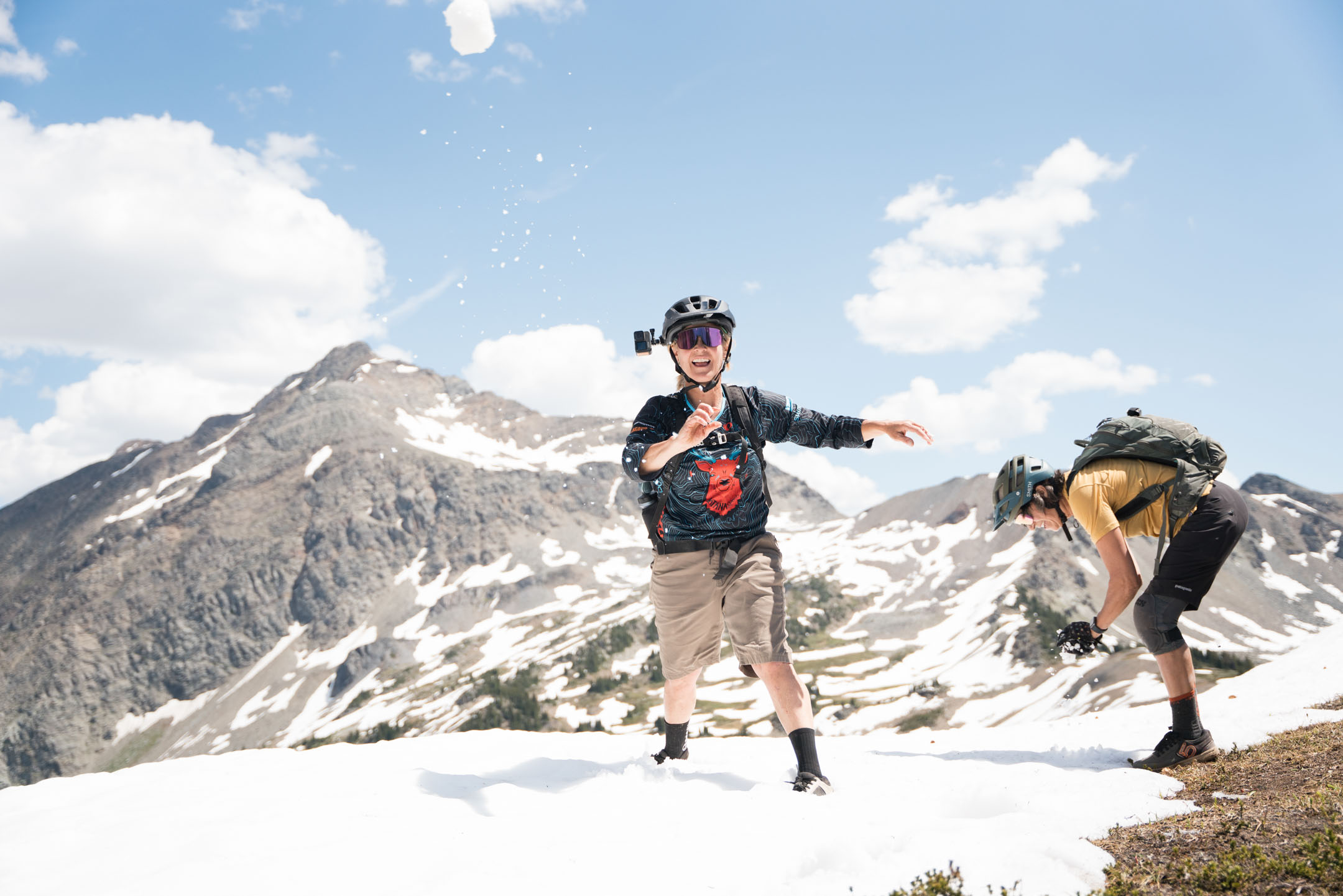
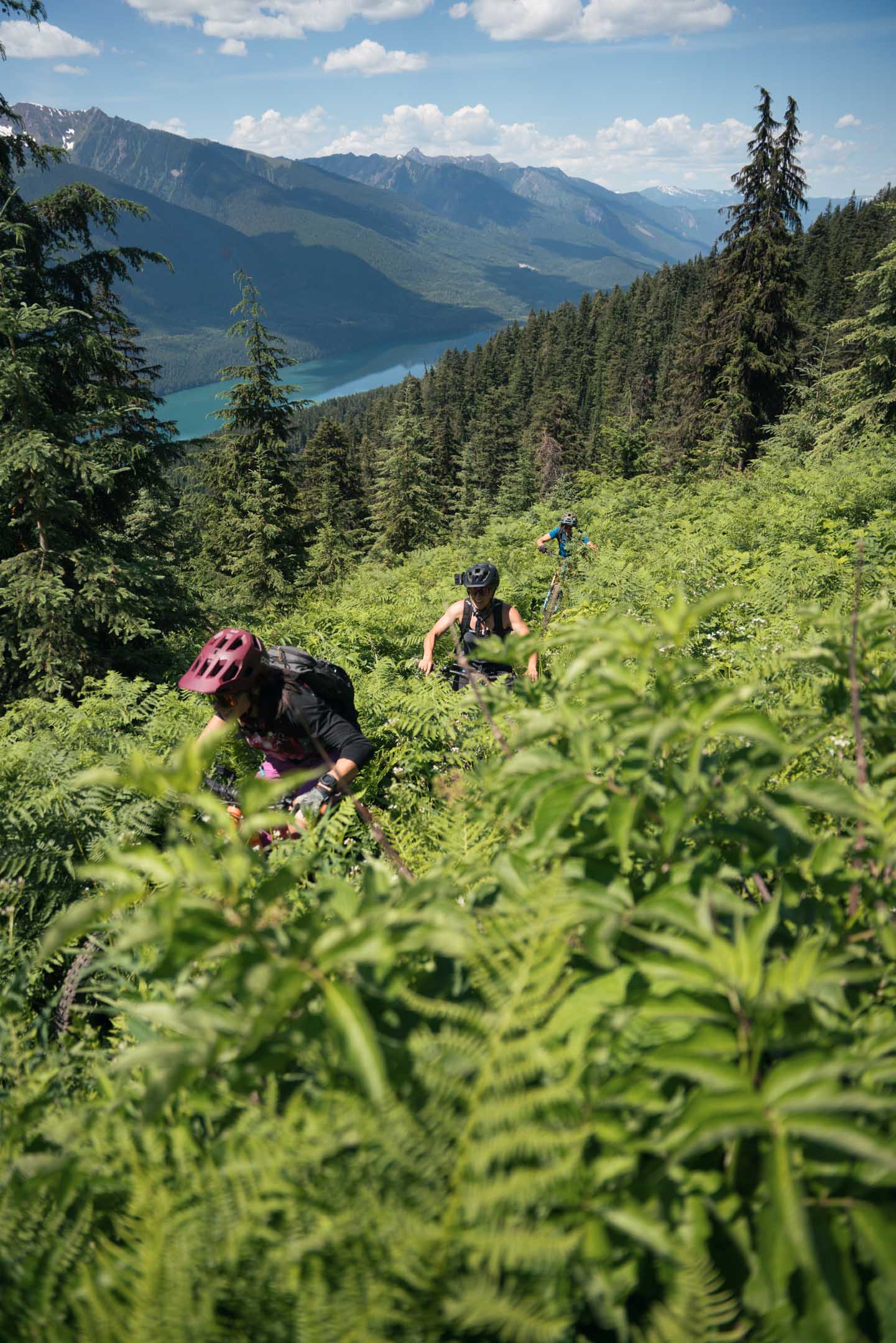
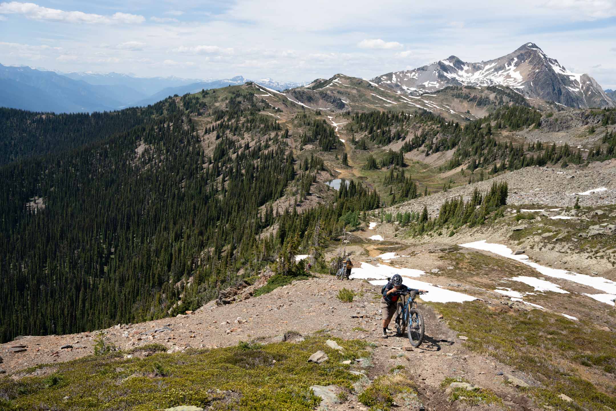
After three hours of climbing over four miles, we finally made it above the treeline. The higher elevation revealed a changing ecosystem: trees were getting smaller, horseflies bigger, and soggy subalpine bogs more prevalent.
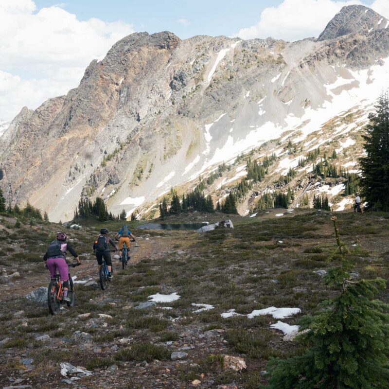
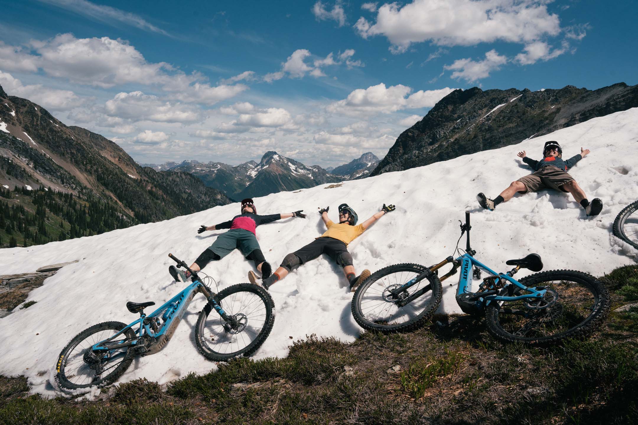
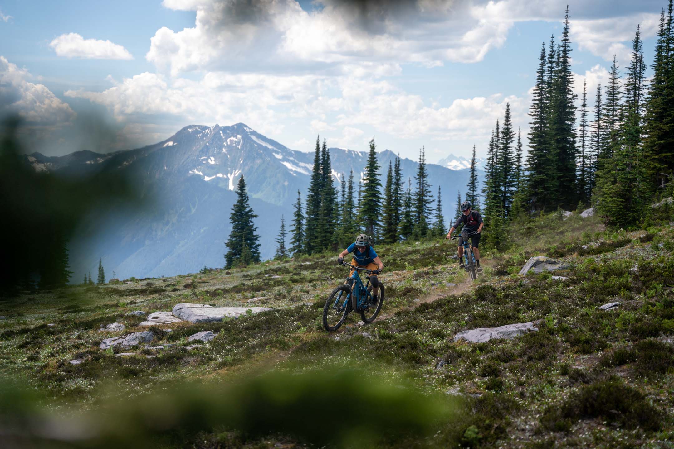
When we crested the ridge, we could see to the east the famous Bugaboos of the Purcell Mountain range – massive, jagged granite spires pointing skyward. To the west, the Monashee range of endless glaciers, massive timber, and teeming wildlife at every elevation. The trail undulated across alpine meadows still dotted with snow, and each alpine basin we entered unlocked fresh views of what was next.
We constantly reassessed the route,
encountering intersections that led to lakes, viewpoints, or dead ends, occasionally taking wrong turns or retracing our tracks. After lightly crossing several exposed scree fields, snow, and a few punchy climbs, we finally dropped back into the trees, where tight, twisty forested singletrack limited our sightlines. I cranked the tunes extra loud to keep the bears informed of our whereabouts.
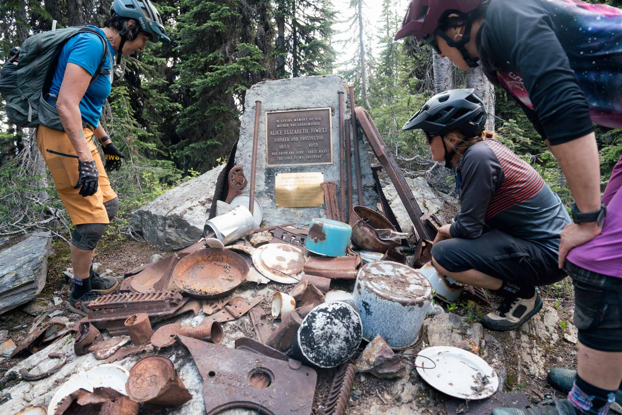
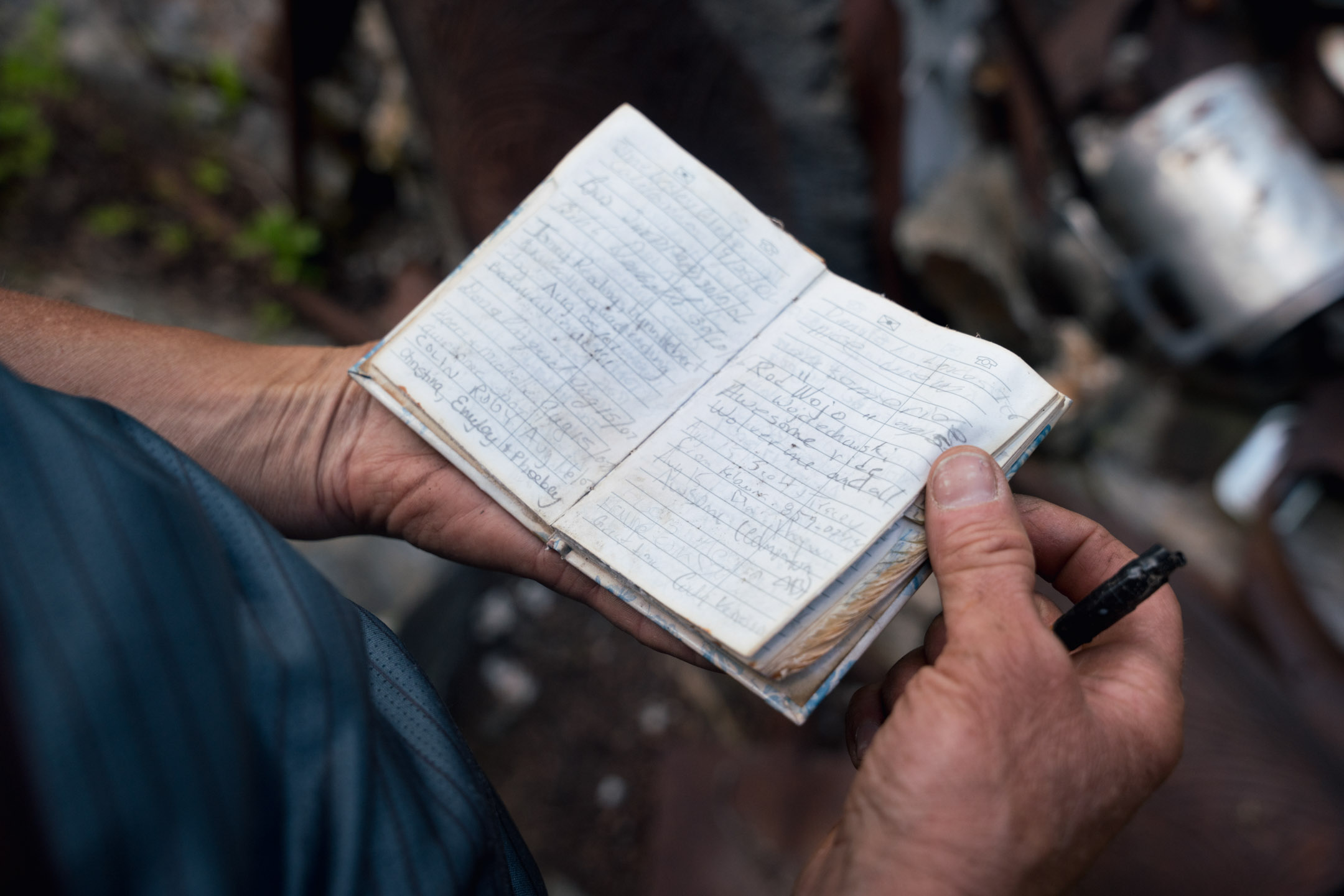
Eventually, and seemingly out of nowhere, we rounded a bend halfway down the mountain and found the memorial dedicated to Trout Lake’s iconic Alice Jowett…the inspiration for our trip and a legend of this area.
Near a quiet meadow
by a stream stood both her memorial and her famed mining claim, the Foggy Day. Her ashes had been scattered where her cabin once stood, taken by fire decades ago. We paused there, honoring her fierce spirit and signing the tiny guest book placed inside an old coffee can by her great-great-granddaughter, Nicole Daney. Alice roamed these wilds well into her 80s, covering ground by horseback and foot, always with a rifle nearby, always with family and friends.
We got back on the bikes and headed for the top of Rady Road. This steep, rocky descent would drop us over 4,000 feet to the valley below, and to the truck our support crew had left for us earlier in the day.
It was a rodeo of a descent to end the day,
baby heads galore, super steep, and really loose. The day totaled about 20 miles, with over 4,000 feet climbed and descended. We hugged it out at the truck, grateful that Larry was okay and ecstatic that we found our way. Happening upon Alice’s memorial felt surreal, but in the magic of these mountains, anything is possible.
Back at the Windsor our crew had dinner ready, hot burgers and cold beer. A luxury after a big day in the backcountry. Larry was still recovering from the blow to his head, and with increasing pain and queasiness, he decided to opt out of day two. We’d miss him and his presence in this grizzly-laden backcountry, but we were committed to continuing as a crew of four.
Day two
Day two began with a truck bump up the Le Beau FSR, which would put us near where we ended the day before. This section of the route was totally unfamiliar to me, I hadn’t scouted it in previous years, and the GPS track I had for day two was incomplete. This ride is not on Trailforks, nor are current conditions known or updated.
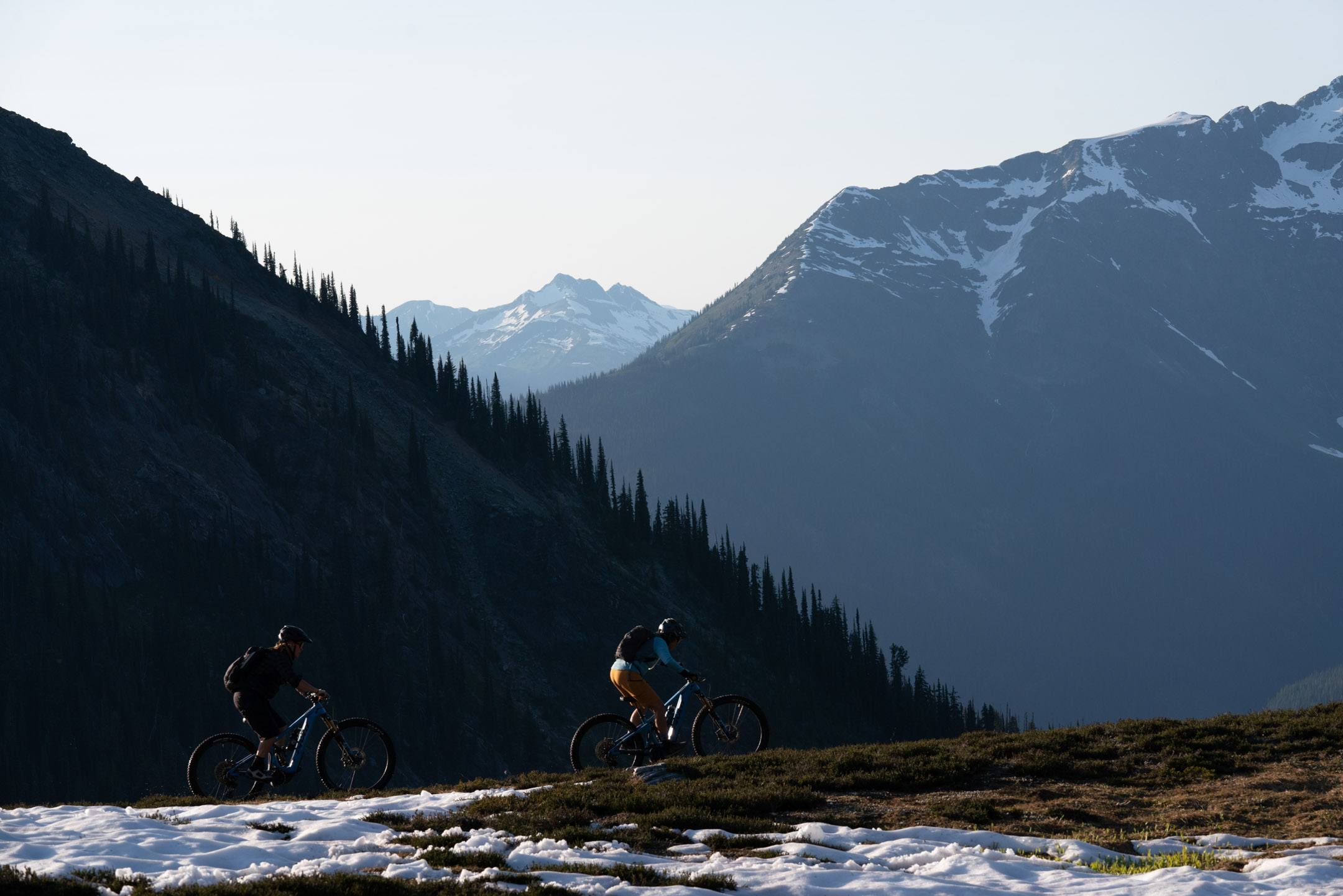
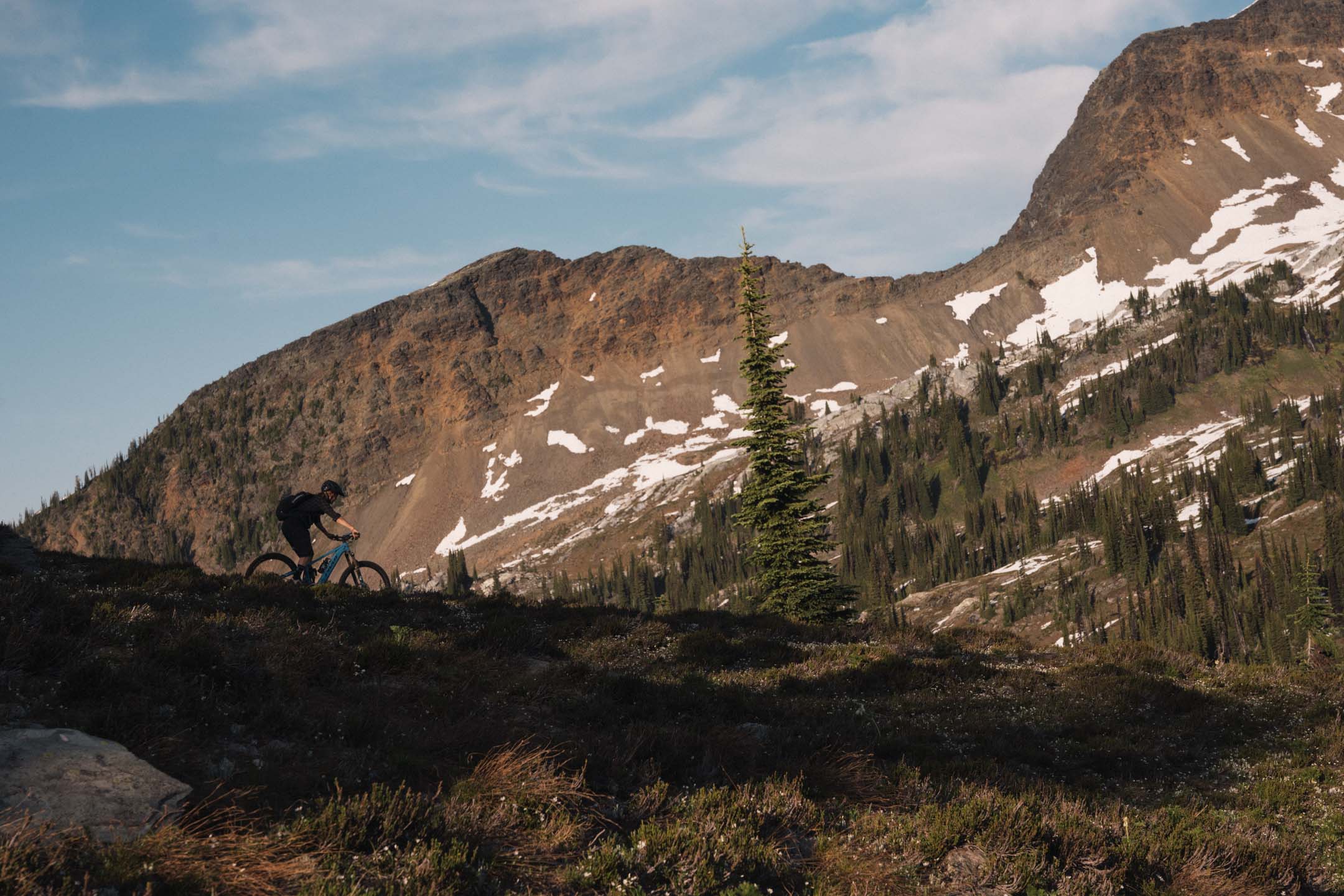
The start of day two was stunning, lush alpine meadows, enormous waterfalls, and endless panoramic views. The trail meandered atop the ridge as we headed toward our goal, the American Creek descent, another forest service road that would drop us down to the valley. The day began easier than the previous one, offering a gentler mix of climbs and descents… or so we thought.
The mellow terrain didn’t last.
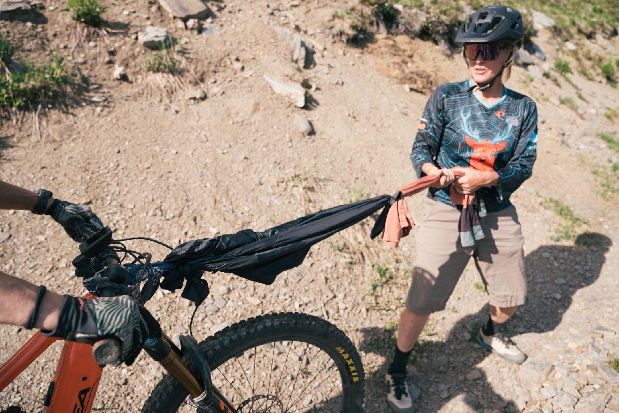
Before long, we found ourselves hiking our bikes up impossible climbs and facing directional challanges. Through one high-speed, rocky section, we heard Kim yell out, “TABERNAC!” A French-Canadian term for “OH SHIT!” Her derailleur had catastrophically blown apart into pieces. Though we retrofitted her bike to a single speed, the chain alignment was hooped, and it kept snapping under load. We removed it altogether, and Kim would be hiking from here.
Not long after sorting Kim’s mechanical issues and getting back on trail, the route abruptly ended into a glacier, of all things. No detour around. No way over.
We tried alternate routes, only to bottom out at more dead ends. Kim was getting frustrated with pushing her bike, and we were getting nervous about finding our way out.
Seemingly out of options, Jen came up with a brilliant idea to fly the drone! With just a bit of battery left, we launched and were able to spot a trail in the basin below. The drone showed a steep access route between some cliff bands that would allow us to descend to the trail. Invigorated and hopeful, we scrambled down and rejoined the route.
I towed Kim on the remaining climbs
using an inner tube tied between our bikes. It worked beautifully as we eventually connected to American Creek, an eight-mile forest service road descent, with what felt like hundreds of switchbacks. We hooted and hollered the whole way down, again warning the bears as my speaker was dead.
When we hit the truck, we hugged and high-fived in a mix of relief, disbelief, and accomplishment.
“That was the hardest thing I’ve ever done!” said Jen.
“Holy shit, 20 miles in 7 hours!” said Anne.
“Unbelievable!” said Kim.
And me, after almost five years of obsessing over this ride and taking a deep dive into Alice and the town’s history, I felt further connected and inspired. There’s a deep gratitude in reflecting on the past as it’s currently shaping my present.
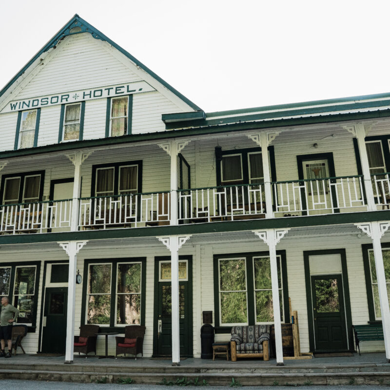
That night at the Windsor,
cold beers and big stories flowed. It felt like Alice was with us, quietly nodding along… and sometimes not so quietly. It’s no secret that past and current guests and workers at the Windsor have experienced her ongoing presence at the hotel. Not a haunted vibe, but a cheeky one.
In 1946, at the age of 93, Alice Jowett finally sold the Windsor after decades of service to this rugged corner of BC. Her passion for the mountains fueled our own journey, and by the time we left Trout Lake, we were already planning next year, more adventures to come, in the footsteps of Alice.


